
Uinta-Wasatch-Cache National Forest Overview
The Uinta-Wasatch-Cache National Forest is located in northern Utah with a small portion stretching into southwestern Wyoming. The forest surrounds Salt Lake City and as such, receives a good amount of visitation. It is divided into seven Ranger Districts: Salt Lake, Kamas/Heber, Ogden, Pleasant Grove, Spanish Fork, and Logan in Utah; and Evanston/Mountain View in Wyoming. The forest’s name pays homage to its beauty and Native American heritage. First, ‘Uinta’ is a Native American word meaning “pine tree” or “pine forest”. Next, ‘Wasatch’ is a Ute Indian word meaning “low place in high mountains”. Finally, ‘Cache’ is a French word referring to the caves used by trappers to hide their furs. Scenic beauty in the forest offers unlimited recreational opportunities throughout the year including the best hikes in Uinta-Wasatch-Cache National Forest described below. However, with over 1700 miles of trail, there are many great hikes to experience that are not included.
| State | Utah; Wyoming |
| Nearest Metro Area | Salt Lake City, UT |
| Area Size | 2,169,596 acres |
| Established | February 2, 1897 |
| Hiking Trails | 1,700 miles |

Thoughtful designs inspired by America’s National Parks.
The National Park Series — custom designs drawn from the landscape.
Trailhead Traveler’s Recommended Best Hikes in Uinta-Wasatch-Cache National Forest
(*** = Best hikes in Uinta-Wasatch-Cache National Forest)
Amethyst Lake Trail – 12.9 miles out and back

Very beautiful but rocky trail in the High Uintas that leads to Amethyst Lake. Begin the hike from the Christmas Meadows Trailhead on the Stillwater Trail hiking south for approximately 6.5 miles. Most hikers will do an overnight and camp near the lake before returning to the trailhead. The lake itself is situated in a gorgeous cirque basin at the head of the Ostler Fork Drainage.
Bald Mountain Trail – 2.8 miles out and back

Bald Mountain is a nearly 12,000′ peak whose summit can be reached in less than 1.5 miles. The trail climbs about 1200′ and is quite exposed so keep that in mind if you are interested. The views near the top of the many surrounding alpine lakes are incredible.
Bells Canyon Trail*** – 9.6 miles out and back

This is a very popular trail that leads to two reservoirs and a waterfall in the beautiful Bells Canyon. Most hikers turnaround once reaching the Lower Falls via a side trail less than 2.5 miles from the trailhead. The trail steepens and to reach the Upper Bells Canyon Reservoir will require you to hike over 4000′ in elevation in less than 5 miles.
Cecret Lake Trail to Sugarloaf and Devil’s Castle – 4.2 miles out and back

Depending on how far you want to go on this trail, it could be an easy or very difficult hike. Hikers will reach Cecret Lake in less than a mile from the trailhead at Albion Campground. You can return to the start or continue up the steep climb up onto the ridge overlooking the lake. From here, you can either head right up the easier to reach Sugarloaf Mountain or to the left towards Devil’s Castle. This route will require more scrambling and climbing as the ridge shrinks the closer you get to the top. However, the views are unbeatable. Be careful on your way back down as the rocks are loose and you’ll have to lower yourself in many tricky spots.
Deseret Peak Wilderness Loop – 8.4 mile loop

Deseret Peak Wilderness, just south of Salt Lake City, has all of the beauty of the Wasatch Mountains with none of the crowd. Though we recommend this loop which takes you along the summit of Deseret Peak, there are plenty of great trails in the area to entice any hiker! The loop we recommend climbs steadily over 3500′ on a combination of trails including Mill Fork, Stansbury Crest, and Dry Lake. The trailhead leaves from the Loop Campground at the upper end of South Willow Canyon Road.
Donut Falls Trail – 3.4 miles out and back

Family friendly hike that is a great option no matter what time of year it is. The trail is short and flat and the falls at the end are very fun to see. Depending on where you begin and if you can park within the campground, your roundtrip mileage might not be as far.
Dry Creek Trail to Horsetail Falls – 4.4 miles out and back
Short but steep hike up a wooded canyon to Horsetail Falls. The trail accesses the heart of the Lone Peak Wilderness area. The ascent can take your breath away but the view of the falls is worth it. This is also a great option in the winter when the falls are frozen over.
Henry Fork Trail to Kings Peak – 27.8 miles out and back

This is the most popular route to the highest point in Utah, Kings Peak (13,528′). From the parking lot of this trail, you can expect a series of rolling hills for the many miles leading up to Gunsight Pass. From the pass, the trail continues down into Painter Basin which eventually heads up towards Kings Peak, and ends at the Uinta Highline Trail about 1.5 miles from Anderson Pass.
Lake Blanche Trail*** – 7.4 miles out and back

Easily one of the best hikes in Uinta-Wasatch-Cache National Forest, this is also a favorite alpine lake hike in the entire state of Utah. The trail is quite steep; climbing over 2500′ in elevation before reaching the lake. At the end of the trail, you can also access Lake Florence, Lake Lillian, Dromedary Peak and Sundial Peak.
Lofty Lake Loop*** – 5.2 mile loop

This hike perfectly encapsulates the beauty of the High Uintas passing several lakes along the loop. In addition to Lofty Lake, hikers will also travel by Scout Lake and Kamas Lake. Start from the Pass Lake Trailhead and go counter-clockwise to avoid longer and rockier stretches of incline.
Mount Olympus Trail – 7.0 miles out and back

Elevation gain is 4,158 feet and the trail is extremely steep at times. Major destinations are Summit of Mount Olympus and Tolcats Canyon Waterfall. This trail offers the choice between a steeper, more challenging route, or the more gradual ascent by the use of a series of shortcuts made by hikers over the years. The Mount Olympus Trail offers panoramic views of Salt Lake Valley and much of the Wasatch Range from Lone Peak on the south to Francis Peak on the north. It also contains a section known to beginners as “Blister Hill”.
Red Pine Trail to Pfeifferhorn*** – 10.8 miles out and back

This is one of the best ways to access the northern end of the Lone Pine Wilderness. It also takes you to a couple of beautiful and popular mountain lakes and one of the most scenic and most frequently visited peaks on the south side of Little Cottonwood canyon. As with most difficult trails, the crowd dies down significantly after reaching Red Pine Lake. From the lake things get much more difficult as you will make your way on the ridgeline. Much of the hike here is more of a boulder scramble. Pfeifferhorn’s summit sits at 11,326′ and is definitely one that you should not pass by!
Stewarts Cascade Trail – 3.8 miles out and back

The Stewarts Cascade Trail departs from the south side of the Mount Timpanogos TH, traveling 1.9 miles to the scenic 200′ tall Stewarts Falls. This trail is an excellent day hike for families with children.
Timpooneke Trail to Mt. Timpanogos*** – 14.6 miles out and back
Timponeeke trail is a beautiful trail that climbs steadily up the Giant Staircase to connect with both the Timpanogos Summit trail and the Mount Timpanogos trail. This is one of the most used trails on the Uinta-Wasatch-Cache NF and as such Saturdays and holidays can be prohibitively busy. A couple of waterfalls can be seen from this trail. Approximately 1-1/2 miles from the beginning, the trail passes Scout Falls where there is a rustic overlook. For those desiring only a short hike, this is a good turnaround point. The trail continues up the Giant Staircase, passing a number of small falls and open meadows. As the trail climbs higher, it crosses a number of rocky slopes, eventually entering a large open basin below the final ridge to Emerald Lake where it joins the Aspen Grove and Summit Trails. The Summit Trail proceeds across a large rocky slope at an easy grade but then becomes steeper on the many switchbacks up to the summit house where spectacular views can be seen in every direction.
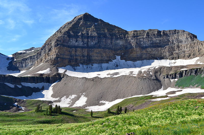
Featured Image: The Wasatch Front, Photo by Don LaVange

Don’t forget to stock up on the essentials before you plan your next hiking or camping trip! We have recommendations on:
TENTS
HIKING BOOTS
AND MORE!