
Yosemite National Park Overview
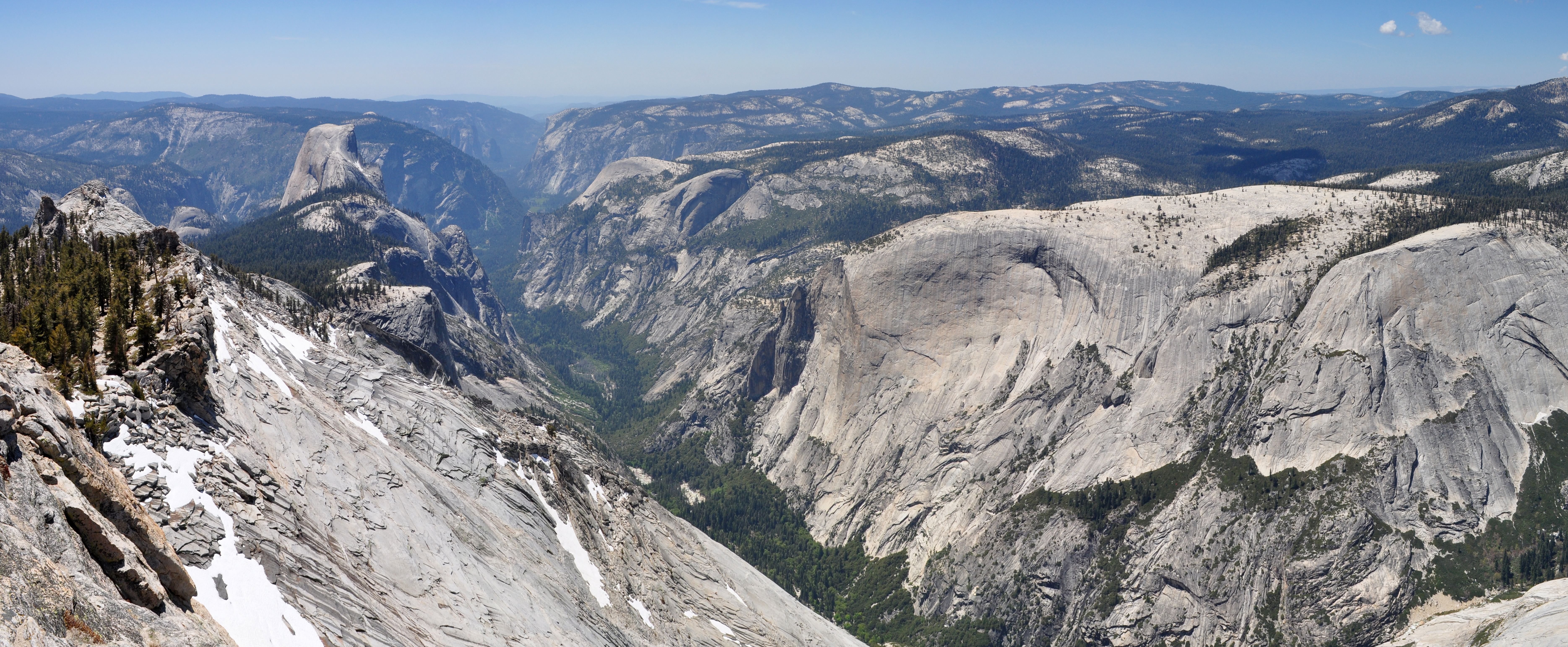
On average, about 4 million people every year visit Yosemite National Park located in the central Sierra Nevada of California. Most of the visitors drive through Yosemite Valley (only 1% of the park’s area) and check out all the highlights from their car, but getting out on the trails is the only true way to experience this beautiful national park. Half Dome, El Capitan, Yosemite Falls, Vernal and Nevada Falls are all found in the valley which is why it is so popular. Below is our list of the top 10 best hikes in Yosemite National Park that you have to explore!
| State | California |
| Nearest Metro Area | Fresno, CA |
| Area Size | 759,620 acres |
| Established | October 1, 1890 |
| Hiking Trails | 800 miles |

Thoughtful designs inspired by America’s National Parks.
The National Park Series — custom designs drawn from the landscape.
Trailhead Traveler’s Recommended Best Hikes in Yosemite National Park
Half Dome

Half Dome is widely known as one of the most dangerous and difficult hikes in the world but if you’re an avid hiker, it is a must-do. Having said that, it was a no brainer to have Half Dome top Trailhead Traveler’s best hikes in Yosemite National Park. A maximum of 300 hikers are allowed each day on the Half Dome Trail beyond the base of the subdome. A preseason lottery is held each March to obtain a permit to hike up the cables. This will take all day so be sure to start early and check sunset times. The best route to the top is via the Mist Trail (below). The steady climb will lead you to the famous Half Dome cables which allows hikers to ascend the final 400′ without rock climbing equipment. The trailhead is located near the Upper Pines campground.
- 14.7 miles out and back
- 4000′ elevation gain
- Strenuous
Vernal & Nevada Falls Loop

For those unable to hike all the way up Half Dome, I recommend combining the Mist Trail and John Muir Trail to make a loop of these iconic falls. A granite stairway will lead you to the top of the 317′ Vernal Falls. Another steep climb 1.5 miles further will get you to the 594′ Nevada Falls. Use the same trailhead as the Half Dome Trail near Happy Isles and the Upper Pines campground.
- 6.2 mile loop
- 2000′ elevation gain
- Strenuous
Upper Yosemite Falls Trail

This is a steep, arduous climb through oak woodland to the top of the tallest waterfall in North America. Along the way you’ll get great views of the valley and Half Dome at Columbia Rock. Another .8 miles past the top of the falls is Yosemite Point which also offers incredible views of the park. Easily one of the best hikes in Yosemite National Park and one that you must do. The trailhead is located at Camp 4 off of Northside Drive.
- 7.2 miles out and back
- 2700′ elevation gain
- Strenuous
Sentinel Dome

This is a relatively easy hike to both Sentinel Dome and Glacier Point and gives hikers one of the best views in the park. About 1.5 miles past Sentinel Dome, hikers can take the Pohono Trail to Glacier Point – I highly recommend this route compared to the Four Mile Trail (below) but either one will leave you with a great feeling of accomplishment rather than driving all the way to the top. The trailhead is located at a parking area off of Glacier Point Road which is closed in the winter.
- 5.1 miles out and back
- 350′ elevation gain
- Moderate
Cloud’s Rest
Leaving from Tenaya Lake is the easiest way to reach Cloud’s Rest which offers incredible views of Sentinel Dome, Mount Hoffman, and Half Dome. If you have binoculars, you’ll even be able to see hikers climb the cables at Half Dome! The length and being away from the valley also make this a more secluded trail than others in the park. The trailhead is located at a parking area at the west end of Tenaya Lake. Getting here is a bit out of the way but Cloud’s Rest is no doubt one of the best hikes in Yosemite National Park.
- 12.4 miles out and back
- 2200′ elevation gain
- Strenuous
Four Mile Trail

This is a steep climb through a series of switchbacks to the top of Yosemite Valley at Glacier Point. Shuttles can bring you back to the valley but arrangements must be made beforehand. I recommend reaching Glacier Point via Sentinel Dome (above) as it’ll save time and energy but this is a highly recommended trail as well. The trailhead is located off of Southside Drive near Sentinel Beach Picnic Area.
- 9.6 miles out and back
- 3200′ elevation gain
- Strenuous
Lower Yosemite Falls Loop
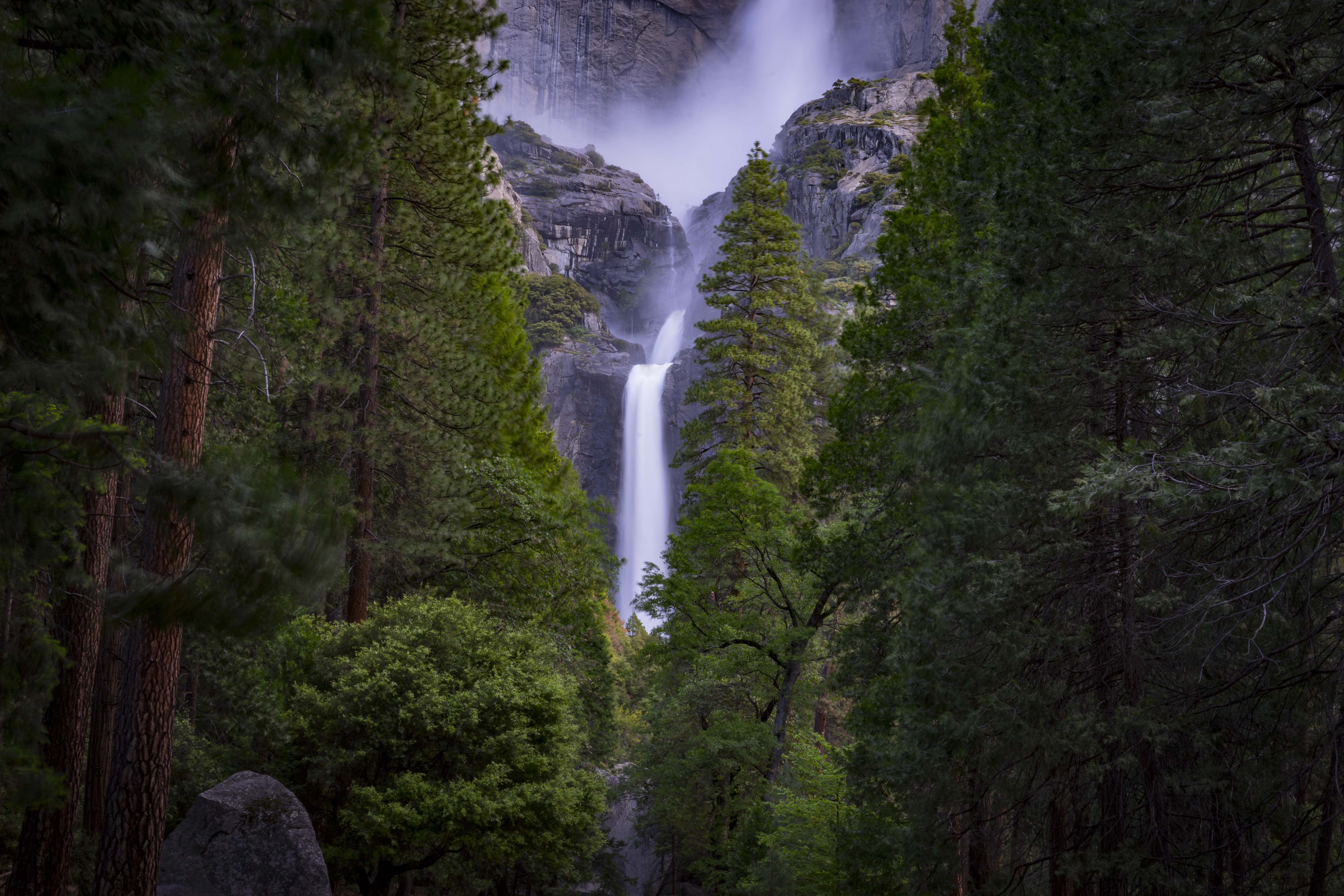
This loop will take you to the final 320′ drop of this massive waterfall. Expect to get sprayed with water when standing on the footbridge at the base. The trailhead is located near a picnic area off of Northside Drive.
- 1.0 mile loop
- 50′ elevation gain
- Easy
Taft Point

Taft Point offers another incredible vantage point of Half Dome and El Capitan. Arriving for a Yosemite sunset is a favorite so bring along a blanket and some snacks! The trailhead is located at the same parking area for Sentinel Dome off of Glacier Point Road, just travel along the trail heading west instead.
- 2.3 miles out and back
- 300′ elevation gain
- Easy
Cathedral Lakes

You’ll climb your way through an alpine forest to a junction that’ll take you to either Lower Cathedral Lake or Upper Cathedral Lake. Great views of Cathedral Peak. The trailhead is .5 miles west of Tuolumne Meadows Visitor Center and follows the John Muir Trail.
- 8.0 miles out and back
- 1000′ elevation gain
- Strenuous
Mirror Lake Loop

The 1st mile of this trail is a paved service road leading to Mirror Lake. The loop begins after that and follows Tenaya Creek past the lake. Mirror lake has little water most of the year and is typically fullest in spring and early summer. The trail is located at Happy Isles Loop Road at Shuttle Stop #17.
- 4.7 mile loop
- 200′ elevation gain
- Easy
Featured Image: Yosemite National Park, Photo by Patrick MILANO

Don’t forget to stock up on the essentials before you plan your next hiking or camping trip! We have recommendations on:
TENTS
HIKING BOOTS
AND MORE!
Paul & Mary Zetelski
Which hotel is the best to stay, in the park,
for day hikes who can accomplish a strenuous hike?
Trailhead Traveler
In Yosemite Valley, where you will find the most popular hikes in the park, lodging will entirely depend on availability and budget. The nicest hotel is easily the Ahwahnee but it could cost quite a bit. Yosemite Valley Lodge is the best family-friendly lodging option. There is also Curry Village and Housekeeping Camp. Around the southern boundary of the park, the best lodging is at Wawona Hotel. And around the northern boundary, off of Tioga Road, your best bet would be Tuolumne Meadows Lodge.
Also keep in mind if camping is an option for you guys that campsites will need to be booked well in advance when they become available or you won’t be able to find a spot.
Hope this is helpful! Enjoy your time there and let us know how it goes!!