
Eldorado National Forest Overview
Eldorado National Forest is located in the central Sierra Nevada region, just west of Lake Tahoe. The forest is bordered to the north by Tahoe National Forest and to the south by Stanislaus National Forest. Two major highways – Highway 50 and Highway 88 – run through the forest, making it an easy drive from Sacramento and the San Francisco Bay Area. Eldorado National Forest ranges in elevation from 1,000 feet in the foothills to more than 10,000 feet above sea level along the Sierra crest. The mountainous topography is broken by the steep canyons of the Mokelumne, Cosumnes, American, and Rubicon rivers. Its climate and topography offer a wide range of recreational opportunities, including hiking, fishing, boating, camping and cross-country and downhill skiing. Details on the best hikes in Eldorado National Forest can be found below!
| State | California |
| Nearest Metro Area | Sacramento, CA |
| Area Size | 615,037 acres |
| Established | July 28, 1910 |
| Hiking Trails | 349 miles |

Thoughtful designs inspired by America’s National Parks.
The National Park Series — custom designs drawn from the landscape.
Trailhead Traveler’s Recommended Best Hikes in Eldorado National Forest
(*** = best hikes in Eldorado National Forest)
Bassi Falls Trail – 4.3 miles out and back

Beautiful hike with several waterfalls along the way – water flow is heaviest in late spring. The trail is a little challenging to follow but it is easy enough for the whole family to enjoy.
Horsetail Falls Trail*** – 3.2 miles out and back
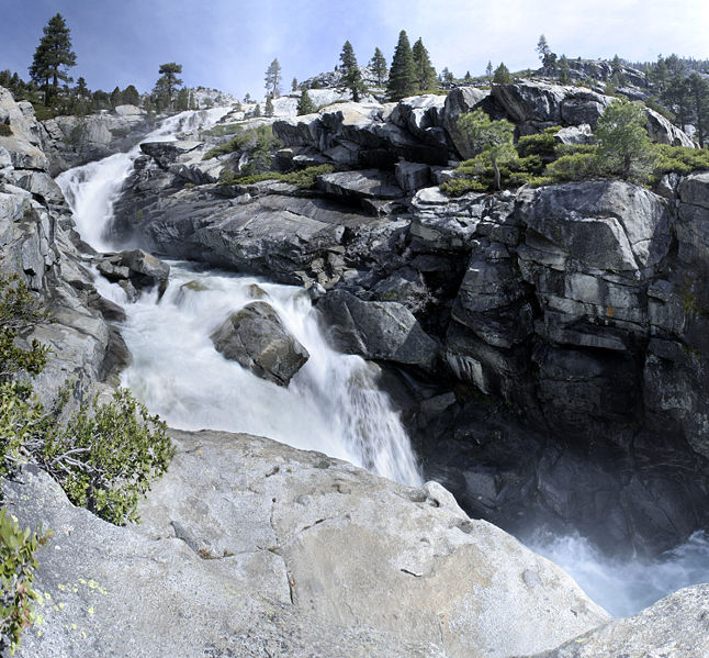
Beginning at the Pyramid Creek Loop Trailhead, this beautiful but somewhat challenging hike takes you right to Horsetail Falls. At the end of the hike there is some rock scrambling required to get to the falls. Late spring is when the water flow is strongest and the falls are at their best but the trail is worth taking at any point in the year.
Pyramid Peak Trail*** – 7.5 miles out and back

Very difficult but very rewarding hike up to Pyramid Peak summit. This is not an ‘official’ trail recognized by the Eldorado National Forest so the trailhead is somewhat hard to find but it is marked all the way until you get near the top where some rock scrambling is required to reach the summit. You cannot beat the views when you’re up there!
Ralston Peak Trail*** – 6.8 miles out and back

Similar to Pyramid Peak Trail above, this is a very challenging out and back hike but provides some of the best views of the Tahoe area once you are at the top. The trail ascends nearly 3000′ to the summit where you can gaze upon the rest of Desolation Wilderness and Lake Tahoe in the distance.
Round Top Lake Loop – 6.9 mile loop

With numerous hikes in the area and lakes to visit, any combination of trails can be used to make a nice circuit loop here. This loop takes you along Round Top Lake Trail, Fourth of July Lake Trail, and Winnemucca Lake Trail in a beautiful pine forest with some short but challenging elevation gains.
Thunder Mountain Trail – 7.8 miles out and back

The trail gradually ascends up the ridgeline to access several peaks along the way including Thunder Mountain. The views from the summit of the surrounding forests are breathtaking. This is probably the easiest summit to complete of the best hikes in Eldorado National Forest while still getting 360 degree views.
Featured Image: Carson Pass, Eldorado National Forest, Photo by Don Graham

Don’t forget to stock up on the essentials before you plan your next hiking or camping trip! We have recommendations on:
TENTS
HIKING BOOTS
AND MORE!